Illustration

Définition
Sens technique
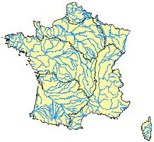
A set of geographic layers presenting hydrographic objects for the French territory. This includes cutting the territory into "hydrographic areas" (river basins) as well as watercourses and bodies of water, and the codification of these objects. The Carthage database (Database on thematic mapping of the Water Agencies) was developed by IGN, the Water Agencies and the Ministry for the Environment and is based on the hydrographic layer of the CARTO database. The National Service for Water Data and Reference-dataset Management (Sandre) disseminates this geo-referenced dataset through its data catalogue and cartographic Atlas.
Source
According to the Ministry for the Environment
Thématiques associées
Translations
Review status
Soumis au comité de relecture.